The historic groundwater flood map is a national-scale flood map presenting the maximum historic observed extent of karst groundwater flooding. The map is primarily based on the winter 2015/2016 flood event, which in most areas represented the largest groundwater flood event on record. The map was produced based on the SAR imagery of the 2015/2016 event as well as any available supplementary evidence. The floods were classified by flood type differentiating between floods dominated by groundwater (GW) and floods with significant contribution of groundwater and surface water (GWSW).
In addition to the historic groundwater flood map, the flood mapping methodology was also adapted to produce a surface water flood map of the 2015/2016 flood event. This flood map encompasses fluvial and pluvial flooding in non-urban areas and has been developed as a separate product.
The historic groundwater and 2015/2016 flood maps are available here.
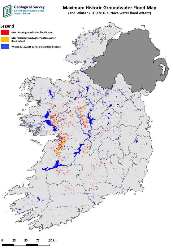
Historic groundwater flood map for Ireland. Red: Floods dominated by groundwater. Yellow: Floods with significant contribution of groundwater and surface water. Blue: Floods dominated by surface water.