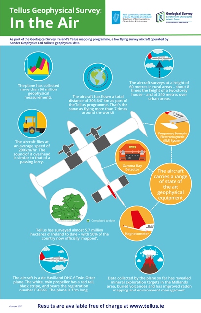
Tellus employs a low-flying aircraft to collect geophysical information on the properties of soils, rocks and waters below ground. Flying at 60 m, the aircraft is able to sense geological properties not apparent from conventional mapping techniques, effectively ‘seeing through’ Ireland’s often deep glacial deposits and extensive peat and soil cover. This method of acquisition is the most rapid and cost-effective means of acquiring regional-scale geophysical data for supporting geological mapping, mineral exploration, radon risk mapping and geothermal energy exploration.
The survey aircraft
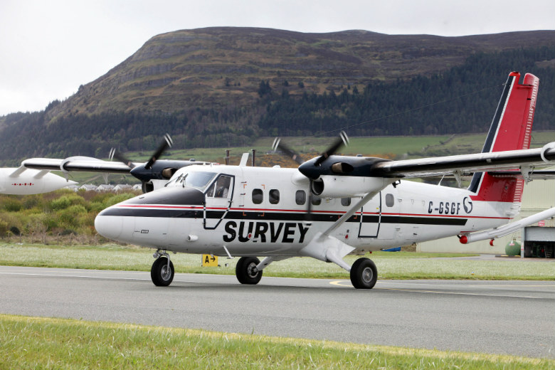
The aircraft is a de Havilland DHC-6 Twin Otter airplane operated by the specialist survey Canadian company, Sander Geophysics Ltd. The white, twin propeller plane has a red tail, black stripe, and registration number C-GSGF, and it is labelled "SURVEY".
The aircraft is equipped with three geophysical instruments which measure the magnetism, radioactivity and conductivity of the Earth below. It undertakes these measurements as it flies at a speed of approximately 130 mph (approx. 216km/h).
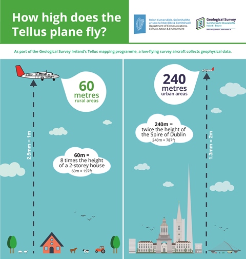
The aircraft flies at 60 m (196 ft.) above ground level, which is approximately 8 times the height of a two-storey house. Survey lines are flown at a spacing of 200 m. When the aircraft is flying at survey height its sounds similar to a passing lorry.
Click on our infographics below for more facts and information