
| 2024-2025, The Wild Atlantic Way Rocks - Carraig Nua GeoscienceThis project will deliver a geospatial app to enhance Wild Atlantic Way visitors’ engagement with the route’s geology and geoheritage in counties Donegal, Leitrim, and Sligo. The app will guide geotourists to 60 new, site-specific online experiences developed to educate them on the geology and geoheritage they can see and engage with.
|
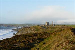
| 2024-2025, Copper Coast UNESCO Global GeoparkThis project will create a new stylised printable visitor map of the Copper Coast Geopark, blending geology with humans and natural heritage. It will also create an online story map version of the printable map using the created map imagery and iconography. The digital version of the map will serve a double purpose as an educational aid for visitors and local school children. It will be an easy place-based introduction to geological and mining heritage. It will also be possible to display the digital version of the map as an in-situ educational activity in the Copper Coast Visitor centre in a digital format, for example on a tablet.
|

| 2024-2025, Joyce Country and Western Lakes Aspiring GeoparkThe aspiring geopark project aims to develop a geodiversity walk in Tourmakeady Woods, Co Mayo, a Coillte owned woodland focussing on recreation and boasting a national trail. The walk aims to showcase geological features by sustainably selecting 10-12 boulders representing the main lithologies from the geopark region and placing them along the existing trail to the waterfall in Tourmakeady Woods. As well as information panels at the start and end of the trail. Each boulder will have its own information panel describing where to find the rock in the geopark region, specific features of the rock and the process behind its formation.
|

| 2024-2025, Classic Mountain Days - Gareth L. JonesClassic Mountain Days - a 300-page hardback, pictorial mountain memoir illustrating over 60 years of highland exploration and adventure. These walks recognise the geoheritage of the geological structure of the hills and the glacial activity, karst development and landscape changes that can be identified. Each of the over 50 treks has a map and an introduction to the geological and topographic features that are present. This book sets wonderful Irish walks and climbs in an international context, bringing geoheritage to a wide community of mountain users.
|

| 2024-2025, Silvermines: A Heritage of Mines and MinersIn supporting community projects and commemorating the significant role that mining played in the history of not just Silvermines, but indeed Ireland, SIGA Hydro plans to publish an edited volume of papers related to the Silvermines mining district and the old Magcobar mine site. This volume will include articles from local community historians, from heritage researchers, and Irish geologists who have worked on Silvermines related projects over the years. The work will be completed in partnership with the Silvermines Historical Society with all proceeds after costs going to this not-for-profit group to support mining heritage at Silvermines.
|

| 2024-2025, Sonairte - Geoheritage of the River NannyWith this project the aim is to incorporate informational signage at the entrance of Sonairte Ecology Centre and Gardens, and along the forest trail to educate visitors about the geological importance of the site. These signs will highlight the geological significance of the River Nanny and surrounding areas. The area boasts a variety of biodiversity. The tidal River Nanny, which runs alongside the forest walk, and has its own salt marsh and mudflats which are a special protection area that is home to a wide array of wildlife.
|
| 2024-2025, Hotwell House - St Gorman's WellThe aim of this project is to create signage and information leaflets for St. Gorman’s warm spring near Enfield, Co. Meath. This site has been studied extensively by scientists from George Victor Du Noyer in the 1800s to present. The warm spring is also a holy well with a unique cultural as well as geological heritage. It is well known locally and also receives curious visitors from around the world. The site will benefit from signage to provide information to local people and the wider public, explaining the importance of our geological heritage, what is known about the spring, and what contributes to the upwelling of artesian warm water.
|

| 2022-2023, Castlecomer Discovery ParkCastlecomer Discovery Park in Co. Kilkenny produced an online-linked geology trail to showcase the geoheritage of the Castlecomer Discovery Park and the geology of the Castlecomer area. The geoheritage highlights include the coal mining heritage and the discovery of rare carboniferous amphibian fossils in 1864. A geological map of the Castlecomer area was created, which is now present on the trail guides and was provided to schools taking the new geology session. The trail aims to promote the geoheritage to schools and the public both within the local area, and the larger catchment of Castlecomer Discovery Park (including Kilkenny, Carlow, Wexford, Waterford and Dublin).
|

| 2022-2023, Copper Coast UNESCO Global GeoparkThe geopark created a new generation of geoheritage trails, focused on the geoheritage and historic mining sites at areas such as Tankardstown Engine house, Ballydowane Cove and Annestown Beach. The information will be printed and posted online. Each geoheritage map will contain points of interest and feature information about the geological heritage of specific areas as well as general information about the area's geology. The maps will be suitable for users to walk or cycle through quiet roads and off-road sections to discover outcrops and other sites of geological interest as they go along.
|
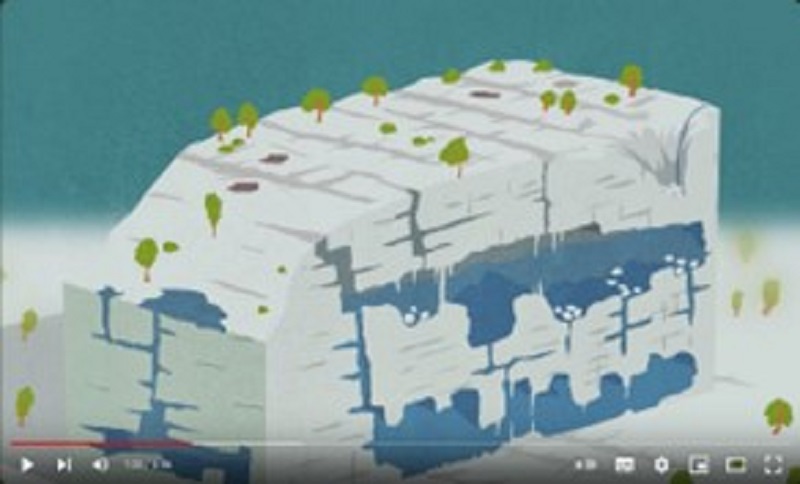
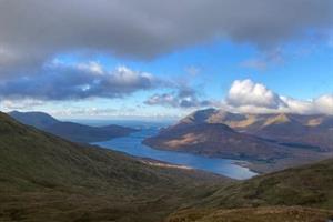
| 2022-2023, Joyce Country & Western Lakes UNESCO Global GeoparkThe aspiring geopark produced an animated video to tell the story of the karst landscape development that takes place over centuries to millennia. The video focuses on the karst landscape of the Western Lakes (Loughs Carra, Mask and Corrib) that has developed in the lower carboniferous limestone and the karstic features to be found there including the Cong Iisthmus area with the Cong Canal development, the Lough Mask shore epikarst feature and the Lough Carra marl lake processes.
|

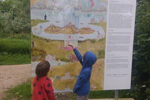
| 2022-2023, Bioregional Weaving Lab The project generated a digital map that captures the essence of both the geological heritage of the landscape and the communities living in the area of the Copper Coast and surrounding areas of Co. Waterford. The adjacent image if from Peter Cook, City Landscapes.
|

| 2022-2023, St John's Old Cemetary Restoration GroupIn a restored eighteenth-century church, now the Nobber Heritage Centre, this small community-based group tell the area's geological story using locally sourced rock and fossil specimens which are housed in display cabinets. Display panels detail various aspects of the local geoheritage including the Kingscourt half-graben, gypsum mines, karst, and drumlin belt Quaternary landscape. The display now has an audio-visual component including drone-captured video of the landscape and some of the more important geological sites.
|

| 2022-2023, Burren & Cliffs of Moher UNESCO Global Geopark This project was to design and produce a series of short animations that graphically tell the story of the geological history of the Burren and Cliffs of Moher UNESCO Global Geopark including the formation of the Burren limestone, the sandstone and shale of the Cliffs of Moher, fossils in the Geopark, the plate tectonic journey and the Ice Age. These stories connect the geological processes with the local landscape and promote geoheritage awareness among all age groups and to a wide-reaching audience.
|
 | 2021-2022, Irish Iron Heritage Foundation CLG
An open-air museum was established during the International Furnace Festival in August with permanent objects and information panels on the past extraction and smelting of local iron ore with special focus given to the local siderite and its relation to the geology of the Burren. |
 | 2021-2022, Copper Coast UNESCO Global GeoparkThis project focused on the digitisation, assessment and presentation of threats to the Copper Coast Geopark geoheritage using novel geotechnical monitoring tools and resulted in a digital, virtual geoheritage tour of Copper Coast Geopark sites. |
 | 2021-2022, Joyce Country and Western Lakes Aspiring GeoparkThis project focused on the development of a geotrail on the Mám Éan section of the Western Way in Conemara, Co. Galway. The work on this trail is ongoing with signage to be in place in early 2023. The geological setting, in particular the Dalradian rock exposures over the Maumturk range, will act as a focus point towards possible future integration of the Western Way in the International Appalachian Trail. |
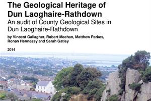 | 2021-2022, Dún Laoghaire-Rathdown County CouncilThe project delivered the story of local geoheritage by generating county specific, highly graphic maps, infographics and imagery along with professionally scripted interpretive content to maximise impact of the communications in print, in person and online. The project also oversaw the successful completion of two geoheritage walks, with popular demand leading to the expansion of the series of planned walks in 2023.
|
 | 2021-2022, Lisdoonvarna Historical SocietyThe project focused on the construction of a pillar-sculpture depicting the local geological stratigraphy and providing a clear visual and tactile structure demonstrating the main geological features of the Lisdoonvarna area. Furthermore, the link between the original spring wells of Lisdoonvarna and local geology was highlighted, adding to local awareness of geoheritage understanding, and promoting the value of this aspect to the town, and its geotourism. Unfortunately the project was delayed and it is anticipated that construction and installation will be completed in early 2023. |
 | 2021-2022, Slieveardagh Mining Group
A geoheritage map of coal mining in Slieveardagh was produced based on the geology and coal mining heritage of the area and a collection of stories from the mines told by miners. This map was given to local schools, libraries and community groups and further enhance local abilities to tell the story of The Slieveardagh Coalfield.
|
 | 2021-2022, Historic Graves ProjectThe project focused on building the heritage of historic graveyards into their geoheritage context, identifying where possible, quarry locations matching different phases of building construction from the early medieval period onwards. This was a collaboration with community-focussed geologists to delve into the geoheritage of historic graveyards. |
| Valentia Island Geoheritage Association (VIGA) is a not-for-profit organization, one of whose aims is to promote Valentia Island's geoheritage and geotourism, in tandem with developing sustainable employment and enterprise on Valentia Island and surrounding areas in Co. Kerry. The Island is home to the world-renowned Devonian tetrapod trackways which showcase one of the earliest traces of land-dwelling vertebrates (amphibians). VIGA seek to promote both the tetrapod trackway and the Valentia Slate Quarry by developing a geotour of these locations highlighting their unique geology. Other initiatives include a promotional poster of Valentia Island geology, a 1-inch geologic map of the Island and Valentia slate coasters with engraved tetrapod footprints. Additionally, the design of a geological lookout point at Valentia Slate Quarry with a dramatic, free standing, slate monolith and interpretative panels highlighting the area's geological history are also proposed. Website coming soon!
|
| Copper Coast UNESCO Global Geopark in Co. Waterford showcases the area's geology and mining heritage. They aim to review and then rejuvenate the existing geoheritage and geology exhibition of the Copper Coast Geopark Visitor Centre. It is proposed to rewrite, redesign, and reprint all panels within the exhibition with a more geologically engaging and up to date format, with separated zones of interest for visitors. Their intention is to increase the geoheritage educational value of the exhibition which will be a significant resource for outreach, primary and secondary schools, and children both in the local area and further afield.
|
| PROJECT Belturbet is a community group in Belturbet, Co. Cavan who seek to develop their town and its environs. To promote the area's geoheritage, they propose to build a life size model of a woolly mammoth on Turbet Island as part of the existing Dreamscapes Trail. Woolly mammoth remnants were discovered on Turbet Island making it an ideal location to highlight the Island's Ice Age past. The woolly mammoth model and associated geological information will act as a focal point for tourists, schools and colleges to visit and learn about the rich geological history of the area.
|
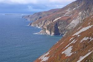
| Oideas Gael are located in southwest Donegal. They seek to raise awareness of the Sliabh Liag peninsula as an area of geological and geomorphological significance by increasing local knowledge of the geology of the area and the geological processes responsible for the formation of the modern landscape. Oideas Gael aims to promote geotourism and geoheritage by creating and delivering educational programs by combining geology within a wider cultural heritage context, for example, exploring the local archaeology, folklore, place names and the geological connections with Scotland and North America. Find more information here.
|
.jpg?RenditionID=15)
| The Cuilcagh Lakelands (formerly Marble Arch Caves) UNESCO Global Geopark is a cross border geopark located in counties Cavan and Fermanagh. The aim of their project was to create an online poetry map linking specific sites around the Geopark, with each having their own poem reflecting the unique geoheritage and geology of that site. They engaged with both new and established poets by commissioning them to write a site-specific poem that would be inspired by the geology of a particular location within the geopark, and there was also engagement with local schools to help pupils to create their own poems about the local landscape and geoheritage. The online Poetry Map was launched on UNESCO World Poetry Day on the 21st March 2022, and can be found here.
|
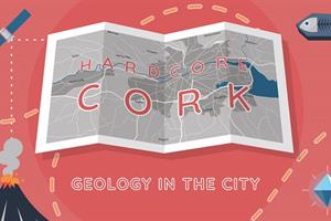
| The goal of this project was to link the archaeological and historical built heritage of Cork City to its geology of Devonian sandstones, Carboniferous limestones and Quaternary sands and gravels. In doing so, it can make Cork's geoheritage accessible and engaging to local people. The project used online innovations, geology walking trails, a virtual exhibition and schools outreach to link Cork City's historical heritage to its geology. Follow the website as it develops.
|