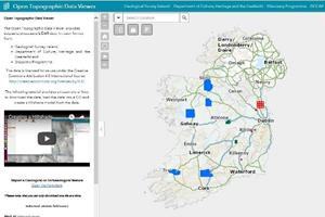
Geological Survey Ireland, a division of the Department of Communications, Climate Action and Environment, has built Ireland's first Open Topographic Data Viewer. The viewer will be launched by Seán Kyne, Minister for Natural Resources, on the 24th April at the annual meeting of the International Association of Hydrogeologists (IAH) being held in Tullamore, Co. Offaly.
The Open Topographic Data Viewer project is a collaboration between Geological Survey Ireland (GSI), the Department of Culture, Heritage and Gaeltacht's National Monuments Service (NMS) and National Parks and Wildlife Service (NPWS) and The Discovery Programme: Centre for Archaeology and Innovation Ireland within the remit of the Heritage Council. These organisations are keen to make all of their high resolution topographic data freely available.
The aim of this viewer is to host LiDAR from all interested government and non-government organisations and to build up a mosaic of available data across the country. These high quality topographic maps are not only fascinating to look at, but making them freely available will definitely stimulate new research and improve existing products and techniques.
Access to the Open Topographic Data Viewer
Press Release