Geological Survey Ireland (GSI) holds the National Geotechnical Borehole Database. This database contains some of the reports of site investigation work undertaken to determine the ground conditions at the location of proposed development projects. It is a valuable resource for:
- planning and optimising future site investigations,
- understanding the subsurface and urban geology
- and for helping construct 2D and 3D models.
The database has been assembled over several decades and has expanded rapidly in recent years with the rapid expansion of the Irish economy. The development projects were undertaken by both the private and public sectors, particularly infrastructure projects. GSI acquires data on a goodwill basis, from consulting engineers, site investigation companies, local authorities and other agencies. Data and report submissions are gratefully accepted and acknowledged by GSI:
 |  |
| Irish Geotechnical Services Ltd (IGSL) | Site Investigation Ltd |
Upon submission, they are included in the national geotechnical database which acts as a secure, national repository. Submissions and queries may be made by contacting GeologicalMappingInfo@gsi.ie .
The database is currently in both hard copy and digital format in an Oracle database. The majority of site investigations are located in the main cities and towns where most developments occur. In addition, there are reports on site investigations in rural areas for national road and gas pipeline construction, and other linear projects such as water/sewerage pipelines.
The reports typically contain a text report and borehole, trial pit and probe logs, as well as field tests and laboratory sample analyses. The data is also important for the modelling of the subsurface geology, in the geological mapping of the overburden (Quaternary sediments) and the bedrock. The investigations are expensive to undertake and should not be lost for future use and access: GSI therefore provides a national, accessible repository for these reports.
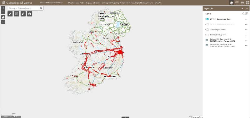
This online viewer gives access to the projects that have been digitised to date. Site investigations are digitised as polygons, boreholes and trial pits as points.
Some site investigations have an associated full report, downloadable from the 'REPORT' field in the attribute table.
Some site investigations do not have an associated report if the report hasn't been scanned yet. In this instance the 'REPORT' field will return 'null' information but a 'REPORTID' number is available in the attribute table. Should you require a report not yet scanned, please contact GeologicalMappingInfo@gsi.ie with the 'REPORTID' number.
As of December 2019, 42287 exploratory holes are georeferenced and digitised as points; 3710 site investigations are displayed as polygons and 2855 reports are available in this viewer.
This viewer will be updated as more reports are scanned and/or more site investigations are digitised.