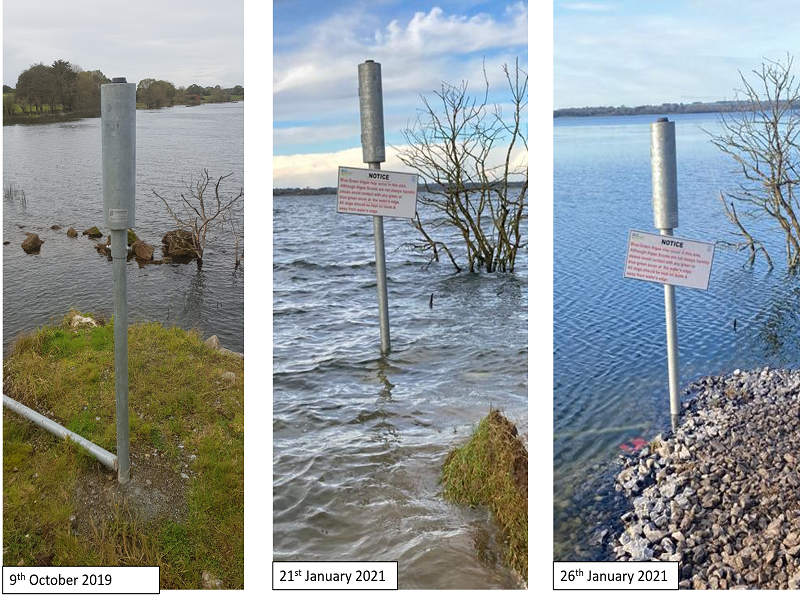
 Fig. 1 - Changing water levels at the GSI monitoring station at Lough Funshinagh
Groundwater
Flooding in County Roscommon.
Recent
heavy rainfall, in combination with already high water levels, has caused water
levels at Lough Funshinagh, Co Roscommon to rise towards unprecedented flood
levels.
While Lough
Funshinagh is designated as a turlough due to its characteristic fluctuating
water levels, it is extremely slow to drain and seldomly empties completely.
The characteristic slow response of Funshinagh means that, unlike other
turloughs in Ireland, it does not get the opportunity to reset it’s flood
pattern each year. This leaves it particularly vulnerable to weather events as
their impacts can carry over from one year to the next.
Following
extreme flooding at Lough Funshinagh in 2016, Geological Survey Ireland
commenced monitoring it as part of its turlough water level monitoring network.
Data from our monitoring stations is available to view and download at our
online web-portal: https://gwlevel.ie/
Geological
Survey will continue to monitor Lough Funshinagh and wish to thank Roscommon
County Council for their assistance in making our monitoring station accessible
during current high water conditions. For more information on our groundwater
flooding monitoring and mapping work, see here