2024 INFOMAR MSc. Module in Collaboration with Maynooth University and SMART Sea School
This year marks the 5th year of the 'Marine Remote Sensing - INFOMAR' Level 9 post-graduate module developed in collaboration with the Department of Geography at Maynooth University. As part of the Masters in Geographic Information Systems (GIS) and Remote Sensing, the module focuses on developing competencies in seafloor mapping and the management of ocean data achieved through in-depth lectures, tutorials and applied training on a state of the art research vessel. The programme is also accredited by the Society of Chartered Surveyors Ireland (SCSI) and the Royal Institution of Chartered Surveyors (RICS) in the UK, laying the groundwork for aspiring Chartered Geomatics Surveyors.
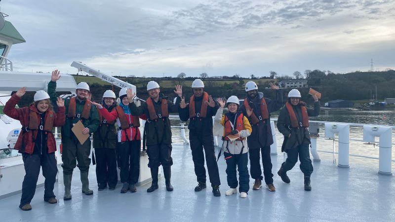
Figure 1: Aileen Bohan (Left) of INFOMAR and Maynooth post-graduate students on the bow of the R.V. Tom Crean in Cork harbour
The classroom component of the module covered key marine remote sensing topics, including an overview of Seafloor Mapping, Ocean Geography and Evolution, Marine Data Science & Product Development, Fundamentals of Oceanography, Seafloor Imaging, Coastal Change, Seafloor Sediments & Processes, Multibeam Technology Focus, Earth Observation, Marine Geophysics, Survey Planning, Geodesy, Marine Habitat Mapping, Seabed Mapping Impacts & the Future of Ocean Science, and Careers and the Ocean Economy. With students from Ireland, the UK, Fiji, the Maldives, China, and the Caribbean, the learning environment is enriched and fosters cross-cultural exchange, enhancing the educational experience.
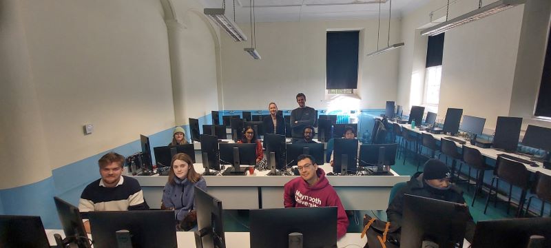
Figure 2: Students and INFOMAR staff during lectures at Maynooth University
In the tutorials, students worked with real survey data to calibrate the multibeam echosounder (MBES) which is a key acoustic instrument in the science of seabed mapping. They had the opportunity to practice data processing, shipwreck reporting, and 3D seabed visualisation using industry-standard software licenses sponsored by QPS. Additionally, students utilised cloud computing with Satellite Derived Bathymetry data from the Sentinel-2 satellite sensors to analyse coastal seabed depth and shape using satellite imagery.
Central to the INFOMAR seafloor mapping module lies the hands-on ship-training component, which offers students a unique opportunity to expand on their theoretical knowledge and immerse themselves in the practical aspects of marine remote sensing on a research vessel. This year's training sessions were held aboard the R.V. Tom Crean, Ireland's newest research vessel. Measuring 52.8 meters in length, with a beam of 14 meters and a draught of 5.2 meters, the vessel is well-equipped for multi-disciplinary scientific research. It can accommodate 12 crew members and 14 scientists for three weeks of survey operations.
Students had the opportunity to stay aboard for two nights, offering a realistic and immersive experience similar to INFOMAR scientists' offshore work conditions. This allowed them to gain insights into vessel operations, crew dynamics, shift work, and the importance of communication among team members. The training delivered by the Strategic Marine Alliance for Research and Training (SMART) Programme and the INFOMAR team is focused on the wide range of marine science disciplines required in mapping the seafloor. Biological sampling of benthic fauna and a remotely operated vehicle (ROV) dives were amongst the highlights for students offshore.
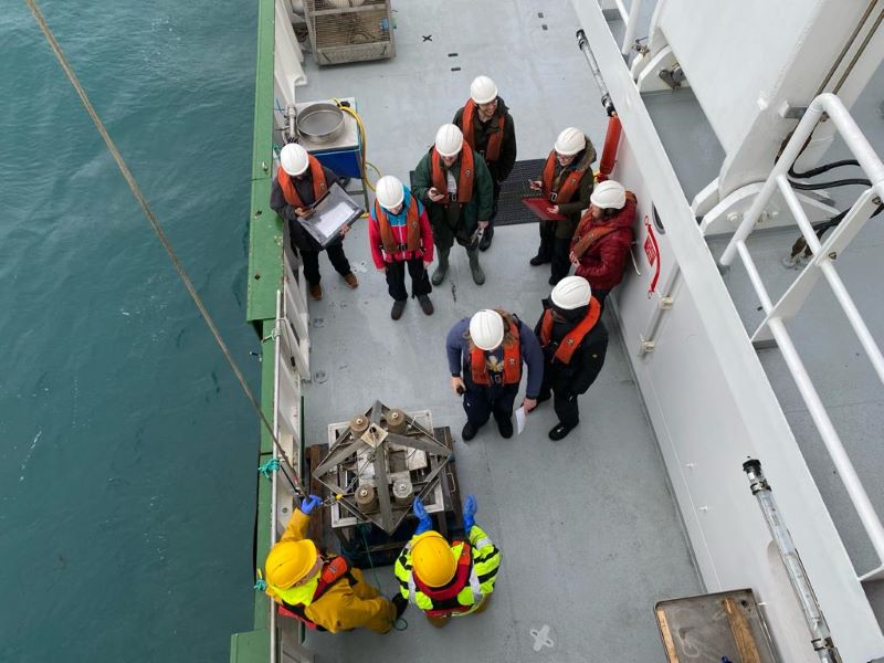
Figure 3: Students from Maynooth University conducting sediment sampling on R.V. Tom Crean
Students were tasked with devising their own survey plans for hydrographic surveys using MBES technology aboard the vessel. They monitored live the MBES data acquisition in the dry lab, visualising seafloor depth and morphology in real-time. Sub-bottom data acquisition provided real-time subsurface imaging to analyse seafloor geology. Post-processing of MBES data included quality control and error correction techniques, facilitated by industry-standard software like Qinsy, Qimera, and Fledermaus, generously sponsored by QPS (www.qps.nl). The research vessel experience not only serves to improve the students' understanding of seafloor mapping, but also provides valuable insight into the dynamic and exciting nature of working offshore.
Aileen Bohan, a Hydrographer with INFOMAR stated “Getting time on a ship is very important because it turns the ideas of mapping the ocean into real skills, linking knowledge learned in class with hands-on experience"
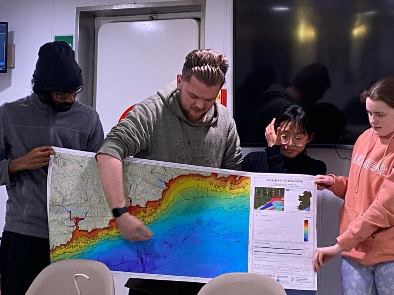
Figure 4: Students present ideas on how they may conduct a survey
Integral to the module are interactive sessions designed to engage students directly with industry professionals. A Q&A session with the INFOMAR team offers valuable insights into the practical applications of marine science, while a careers session featuring guest speakers, including graduate geologists and industry experts, provides a glimpse into the diverse opportunities within the marine sector. On the final day of the module, an industry talk from Gavin and Doherty Geosolutions presented on their utilisation of INFOMAR data for offshore renewable energy (ORE) site selection. The focus on industry applications highlights the real-world impact of the INFOMAR programme on, showcasing the relevance of INFOMAR data to the marine sector's needs and challenges.
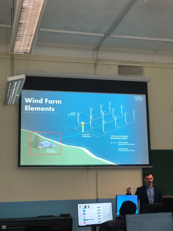
Figure 5: James McAteer of Gavin Doherty Geosolutions presenting on their work with ORE and site selection
A significant development in the realm of offshore wind energy is the recently published report, "Building our Potential: Ireland's Offshore Wind Skills and Talent Needs" (January 2024). The report identifies key roles in the Irish supply chain and underscores the importance of addressing skills shortages in the sector. The Marine Remote Sensing - INFOMAR post-graduate module aligns with these findings by equipping students with the skills and knowledge to address the evolving demands of the offshore wind industry. By bridging the gap between academic learning and industry requirements, the module plays a pivotal role in nurturing talent and addressing critical skill shortages identified in the report.
Dr Michelle Curran, Technical Officer at Maynooth University who attended the offshore training stated “This two-day cruise on-board the RV Tom Crean was a fantastic experience for Maynooth University students to embed the theory they had learned in lectures. While on-board they acquired new, hands-on skills and gained insight into how research at sea takes place."
MSc. Student Christopher Joseph Fox said “The INFOMAR Masters module was a truly eye-opening experience, and it exposed me to a wide range of opportunities within the marine sector. The diverse range of lectures we received from professionals across the industry was invaluable and provided insight into marine research and surveying. While on board the RV Tom Crean, we gained experience from experts in their field on using a host of the latest technologies. From directing the boat's travel route to sending a drop-frame camera to the ocean floor, collecting sound-velocity profiles, and scanning a World War II wreck on the seabed. I could not recommend anything better to someone interested in this industry"
Past participants attest to the module's effectiveness in preparing them for careers in the marine sector. The combination of theoretical knowledge, practical training, and industry engagement equips graduates to tackle the challenges of marine research and sustainable development head-on. As the INFOMAR module prepares for its sixth year, it remains committed to inspiring the next generation of marine professionals and contributing to Ireland's leadership in offshore wind energy and marine research. With continued support from stakeholders and industry partners, the program looks forward to further innovation and success in the years ahead. The INFOMAR team would like to thank the staff and students at Maynooth University, the SMART Programme and the crew of the R.V. Tom Crean for another successful module delivery.
INFOMAR (Integrated Mapping for the Sustainable Development of Ireland's Marine Resource) is a twenty-year programme to map the physical, chemical and biological features of Ireland's seabed. INFOMAR is funded by the Department of the Environment, Climate and Communications (DECC), and delivered by joint management partners Geological Survey Ireland and the Marine Institute.